Whether you're a road cyclist tackling the 35-mile loch loop or a mountain biker exploring forest tracks, Loch Tay offers some of Scotland's finest cycling.
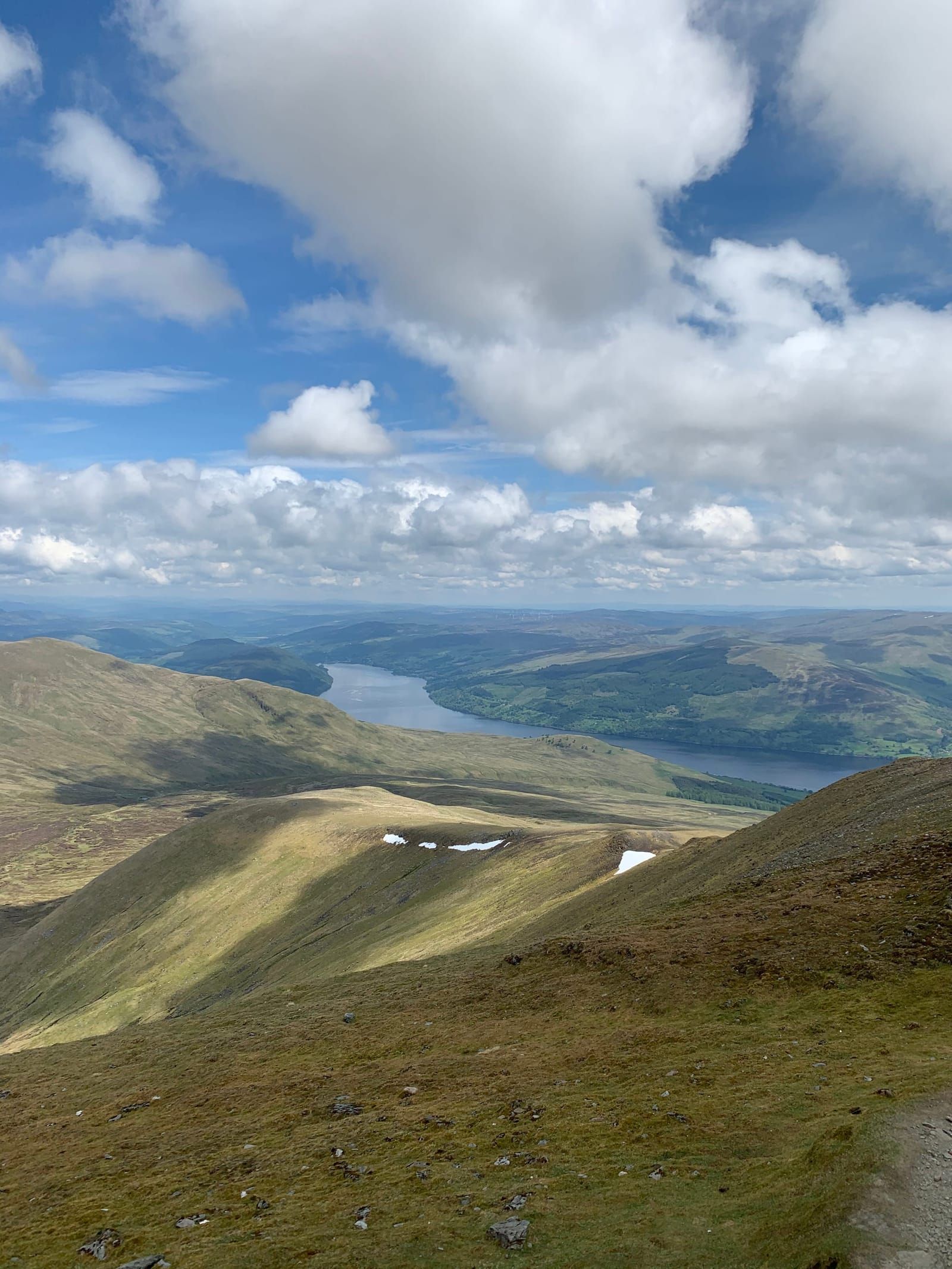
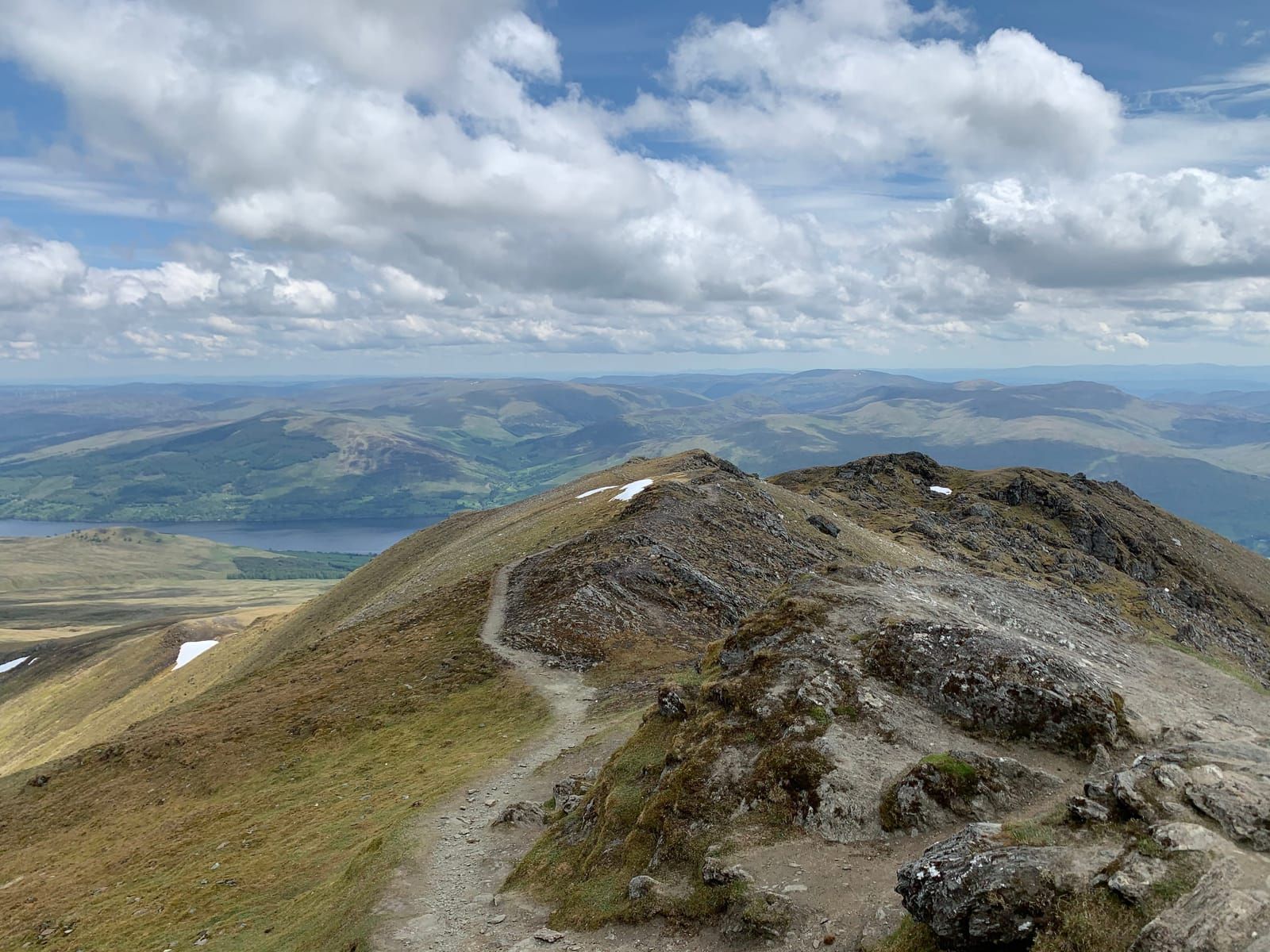
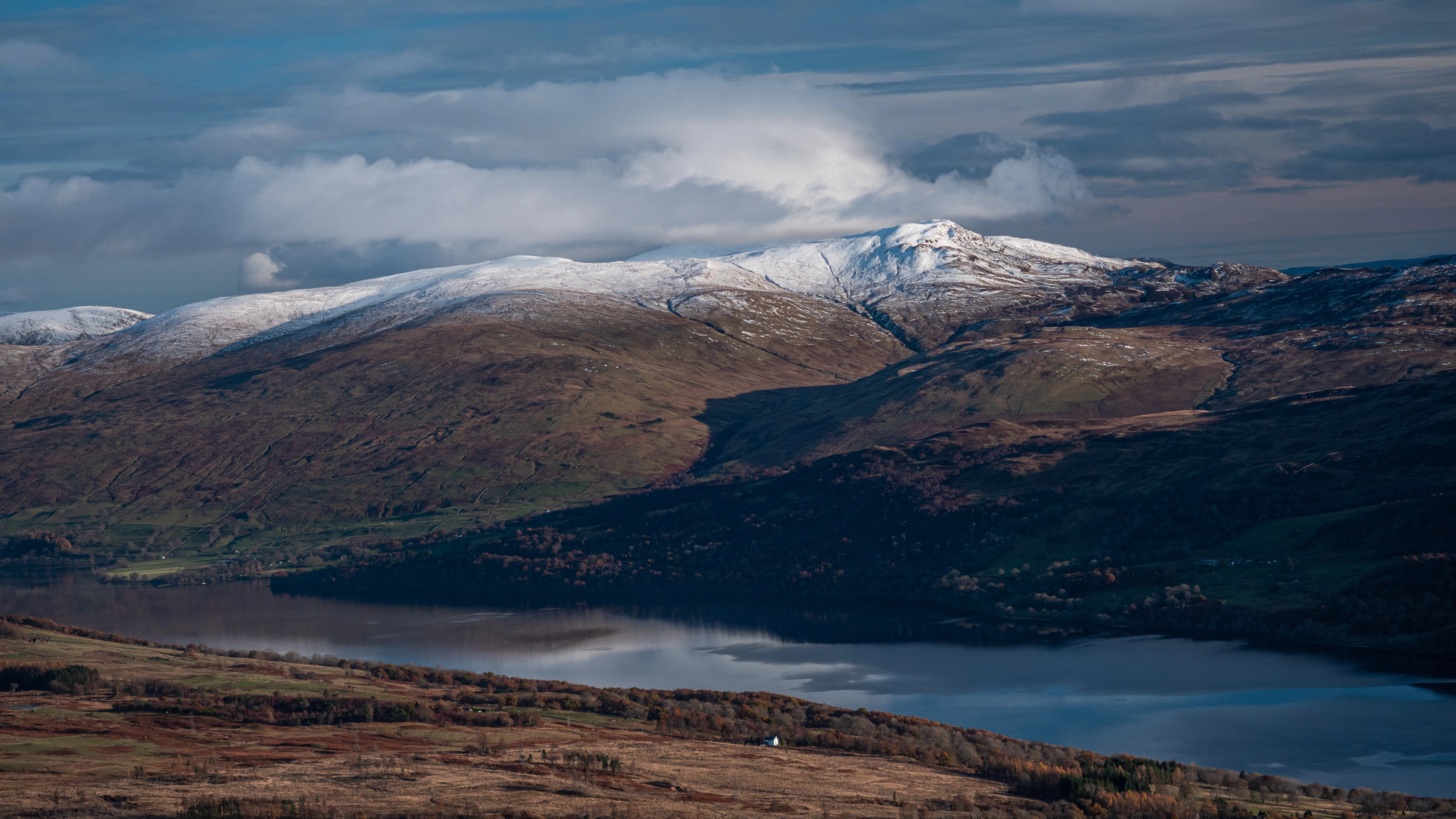
Loch Tay sits at the heart of some of the most spectacular cycling country in Scotland. Whether you prefer smooth tarmac, rugged forest trails, or the satisfying crunch of gravel under wide tyres, the area around the loch has a ride for you. The centrepiece is the Loch Tay Loop — a 35-mile circuit of the loch that combines a fast A-road along the north shore with a gloriously quiet single-track road along the south. But there is much more besides: mountain biking trails in the forests above Killin, the celebrated Glen Ogle trail on National Cycle Network Route 7, and enough gravel tracks and minor roads to keep an adventurous cyclist exploring for weeks.
The Loch Tay Loop: 35 Miles of Highland Cycling
The full circuit of Loch Tay is the classic ride in the area, and justifiably so. At approximately 35 miles (56 km), it is a satisfying day ride for a reasonably fit cyclist, with enough hills to keep things interesting but nothing so steep that it becomes a suffer-fest. The loop can be ridden in either direction, but most cyclists ride clockwise — north shore first, south shore on the return — to get the busier road out of the way early and finish on the quiet south side.
The North Shore: A827
The A827 runs along Loch Tay’s northern shore from Killin in the west to Kenmore in the east. This is a well-surfaced, reasonably wide A-road that carries moderate traffic, particularly in the summer months. It is not an unpleasant road to cycle — the surface is generally good, sight lines are reasonable, and the scenery is magnificent — but you will share it with cars, campervans, and the occasional lorry.
The road undulates gently, never climbing far from loch level. The total elevation gain along the north shore is modest — perhaps 200 metres of cumulative climbing over the 15-mile stretch. Several villages and hamlets provide convenient stopping points:
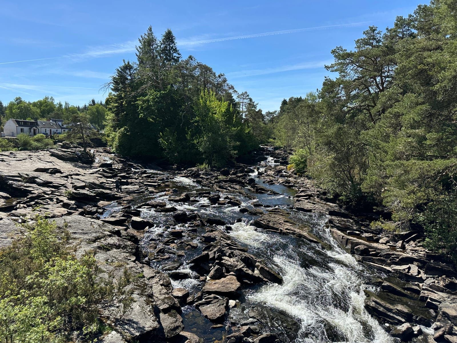
- Killin — The obvious start/finish point with cafes, shops, and bike facilities
- Morenish — A scattered settlement with loch access
- Lawers — Tiny hamlet with views across to the south shore
- Fearnan — Pretty village with a good lochside pull-in
- Kenmore — Handsome planned village at the eastern end with cafes and a hotel
The South Shore: The Quiet Side
The south shore road is the highlight of the loop and one of the finest cycling roads in Scotland. This single-track road runs from Kenmore along the southern shore to join the A827 west of Killin, and it is a revelation.
Traffic is minimal — you may see a handful of cars in an hour. The surface varies from smooth tarmac to rougher sections with patched repairs and occasional gravel stretches. For a road bike with 25mm+ tyres, it is entirely rideable in dry conditions; with 28mm or wider tyres, or on a gravel bike, it is pure pleasure in any weather.
The road winds through a constantly changing landscape:
- Kenmore to Ardtalnaig — The road climbs gently away from the loch before dropping back to the shore, passing through mixed woodland and open sheep pasture. Views across the loch to the Lawers range are superb.
- Ardtalnaig to Ardeonaig — The wildest and most beautiful section. Ancient Atlantic oakwoods line the road, the loch laps at rocky bays below, and the sense of remoteness is complete. This is where you will want to stop, lean the bike against a tree, and simply absorb the view.
- Ardeonaig to Killin — The road gradually climbs away from the loch, crossing higher ground before descending to rejoin the A827 west of Killin. This final section has the steepest gradients on the loop — a couple of sharp climbs that will test tired legs at the end of the ride.
Gradients and Fitness
The Loch Tay Loop has approximately 600 metres of total ascent. There are no brutal climbs, but the cumulative effect of the rolling south shore road means you need a reasonable base fitness. A competent club cyclist will complete the loop in 2.5 to 3.5 hours of riding time; a leisure cyclist or touring rider should allow 4 to 5 hours plus stops.
The hardest gradients are on the south shore’s western end, where a couple of short climbs reach 12-15%. The north shore A827 is much flatter, rarely exceeding 5%.
The South Loch Road as a Gravel Classic
The south shore road has become increasingly popular with gravel cyclists, and it’s easy to see why. The mix of tarmac, rough tarmac, and occasional gravel sections is perfect for a gravel bike with 35-40mm tyres. Several forest tracks and farm roads lead off the main route, allowing you to extend the ride into the hills above the loch.
A popular gravel loop starts from Ardeonaig, heads south into the forestry on the track toward Glen Almond, then loops back via high ground with panoramic views before descending to the loch. This adds roughly 15 km to the south shore road and includes some properly rough tracks that will test both bike and rider.
For the full gravel experience, bring a bike with at least 35mm tyres, low gearing for the steep forest tracks, and a frame bag with tools and spares — you are a long way from a bike shop out here.
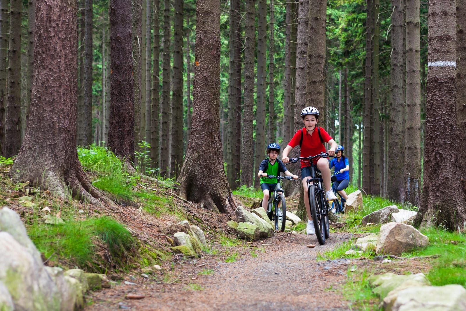
Mountain Biking
Killin and Glen Lochay
The forests above Killin and in Glen Lochay offer excellent mountain biking on a mix of forest roads, singletrack, and purpose-built trails. While there is no formal trail centre (in the style of Glentress or Fort William), the network of forestry tracks and informal trails provides plenty of options:
- Glen Lochay forest tracks — A good network of graded forestry roads suitable for intermediate riders. These climb steeply from the glen floor and reward with fast, flowing descents through Sitka spruce plantations.
- Killin to Lochan Breaclaich — A more demanding route following old stalking tracks into the hills south of Glen Lochay. Remote and wild, this ride is for experienced riders comfortable navigating on rough ground.
- Acharn Forest — A short but enjoyable loop through mixed woodland above the south shore of Loch Tay. The trails are narrow and rooty, best suited to riders who enjoy technical challenge on natural terrain.
Trail Tips
Mountain biking in this area is largely on natural terrain and forest roads rather than purpose-built trails. This means:
- Navigation skills are helpful — Not all tracks are well-signed
- Mud is inevitable — Especially from October to April
- Gates and livestock — You will encounter both; close gates behind you
- Midges — In summer (June–August), stopping in sheltered areas near water will attract clouds of midges. Keep moving or carry repellent
The Glen Ogle Trail: NCN Route 7
The Glen Ogle Trail is one of the jewels of the National Cycle Network and lies just a few miles from Loch Tay. Route 7 runs from Glasgow to Inverness, and the section through Glen Ogle — between Lochearnhead and Killin — follows the line of a disused railway through some breathtaking mountain scenery.
The Route
The trail is approximately 10 miles (16 km) from Lochearnhead to Killin, following the old Callander and Oban Railway trackbed. The railway closed in 1965 following a rockfall, and the route has since been converted into a superb shared-use path.
The gradient is gentle — railway gradients rarely exceed 1 in 50 — making it accessible to families and leisure cyclists. The surface is compacted gravel and stone, suitable for any bike with tyres wider than about 28mm (slick road tyres may struggle on the looser sections).
Highlights
- Glen Ogle viaduct — The trail crosses a spectacular multi-arched stone viaduct high above the glen. Stop in the middle for a vertigo-inducing view straight down to the river far below.
- Mountain scenery — The glen is flanked by steep, craggy peaks, and the views are consistently dramatic
- Wildlife — Red kites, buzzards, and ravens ride the thermals above the glen. Red deer are often visible on the hillsides.
- Historic railway features — Cuttings, embankments, bridges, and the remains of stations tell the story of Victorian-era railway engineering in the Highlands
Getting There
The trail can be joined at Lochearnhead (where there is car parking) or from Killin (follow signs for NCN Route 7 from the village centre). The ride from Killin to Lochearnhead and back is an ideal half-day outing of roughly 20 miles on easy terrain.
Bike Hire
Several operators in the Loch Tay area offer bike hire:
- Killin — Hire shops in the village offer road bikes, mountain bikes, and e-bikes. Most require advance booking in summer.
- Kenmore — Bike hire available, including family bikes and trailers
- E-bikes — Increasingly popular and widely available, making the Loch Tay Loop accessible to riders of all fitness levels. If you are concerned about the south shore gradients, an e-bike transforms the experience.
Prices typically range from £25-40 per day for a standard bike and £40-60 for an e-bike. Helmets are usually included.
Cycling Cafes and Stops
Refuelling is part of the pleasure. The best stops around the loop:
- Killin — Several cafes and the Falls of Dochart Inn serve good food. The village is also the best place for any mechanical needs.
- The Old Flax Mill, Killin — Popular with cyclists, good coffee and home baking
- Kenmore Hotel — Scotland’s oldest inn (established 1572) serves bar meals and has an attractive terrace overlooking the loch
- Taymouth Courtyard — Café with courtyard seating, popular stop at the eastern turning point of the loop
- Tombreck Farm Shop — Organic farm shop on the south shore near Lawers, with rare-breed pork, venison, and seasonal produce
- Ardeonaig Hotel — Halfway along the south shore, a welcome sight for a mid-ride coffee or lunch. Check opening times in advance.
- Bridge of Lochay Hotel — Just west of Killin village, handy for a post-ride meal
Note that there are no facilities at all on the south shore between Kenmore and Ardeonaig, and very little between Ardeonaig and Killin. Carry enough food and water for the south shore section.
Best Seasons for Cycling
- May–June — Long daylight hours, wildflowers, relatively dry weather, and quieter roads before the main tourist season. This is arguably the best time.
- July–August — Warmest weather but busiest roads on the A827. The south shore remains quiet. Midges can be fierce if you stop in sheltered spots.
- September–October — Autumn colours along the south shore are spectacular. Shorter days but often settled weather.
- November–March — The roads are open year-round but daylight is limited, temperatures are low, and the south shore road can have ice and standing water. Not recommended for leisure cycling, but hardy riders will find the winter landscapes extraordinary.
Safety Tips
- Helmet — Always wear one. The roads are quiet but surfaces can be unpredictable.
- Visibility — Wear bright clothing and use lights, especially on the wooded south shore where dappled shade can make cyclists hard to see.
- Spare tube and pump — Essential. You are a long way from help on the south shore.
- Phone signal — Patchy to non-existent on the south shore. Don’t rely on your phone for navigation — carry a map or download offline maps.
- Livestock — Sheep and cattle are frequently on or near the south shore road. Slow down and pass quietly.
- Weather — Highland weather changes fast. Carry a waterproof and extra layer even if the morning looks fine.
- Single-track etiquette — On the south shore road, pull into passing places to let vehicles pass. Give a friendly wave — it’s the Highland way.
- Water crossings — After heavy rain, water can run across the south shore road in several places. Ride through slowly or dismount.
Planning Your Ride
| Route | Distance | Ascent | Surface | Difficulty |
|---|---|---|---|---|
| Loch Tay Loop (full circuit) | 56 km / 35 miles | ~600m | Tarmac + rough tarmac | Moderate |
| South shore only (Kenmore–Killin) | 24 km / 15 miles | ~350m | Mixed tarmac/gravel | Moderate |
| Glen Ogle Trail (return) | 32 km / 20 miles | ~200m | Compacted gravel | Easy |
| Killin forest MTB loops | 10-20 km | Variable | Forest road + singletrack | Moderate–Hard |
| South shore gravel extension | 40 km / 25 miles | ~800m | Gravel + rough track | Hard |
Whatever your style of cycling, Loch Tay delivers. The combination of quiet roads, stunning mountain scenery, and a genuine sense of wildness makes this one of the finest cycling areas in Scotland. Just remember to pack a spare tube, a waterproof, and a willingness to stop and stare — because the views around every corner deserve it.
Mentioned in this guide
Falls of Dochart Inn
Killin
Killin's iconic pub with a terrace overlooking the famous falls — great food, real ales, and Highland atmosphere.
Kenmore Hotel
Kenmore
Scotland's oldest inn, established in 1572, with beautiful lochside setting and excellent dining.
Ardeonaig Hotel
Ardeonaig
A romantic, secluded lochside hotel on the peaceful south shore of Loch Tay.
Bridge of Lochay Hotel
Killin
Traditional Highland hotel bar and restaurant with views over the River Lochay — a warm, welcoming stop west of Killin.
Taymouth Courtyard
Kenmore
A gift shop and deli near Kenmore, stocking local makers, Scottish foods, and carefully chosen homewares.
Tombreck Farm Shop
Lawers
Organic rare-breed farm on the south shore of Loch Tay, selling free-range pork, venison, lamb, and more direct from the land.
The Old Flax Mill
Killin
Artisan bakery and café beside the Falls of Dochart, with freshly baked sourdough, pastries, and superb coffee.