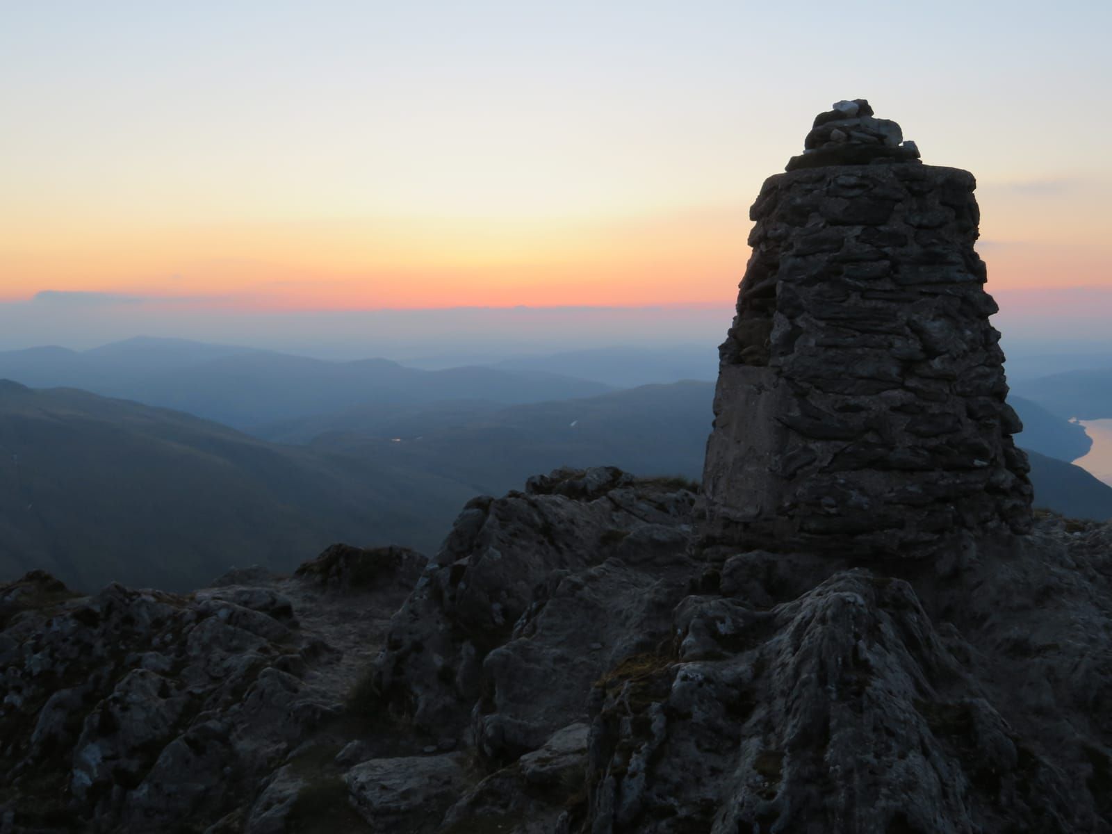
Ben Lawers Summit via Beinn Ghlas
The classic Munro route up Scotland's 10th highest peak, with two summits and stunning views across the Highlands.
Popular guides
More outdoors
Find by type
Our favourites
Makers & artisans
Shops & local produce
Moderate walk
A scenic riverside circuit through Scotland's longest enclosed glen, passing ancient bridges, dramatic rock formations, and the legendary Macgregor's Leap.
Distance
8 km
Duration
3 hours
Ascent
200m
Route type
circular
Parking
Small car park at Bridge of Balgie
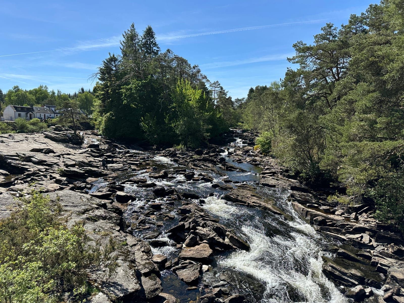
Glen Lyon is Scotland’s longest enclosed glen — a 34-mile ribbon of river, woodland, and ancient history stretching deep into the Highland interior. It is also one of the most beautiful, and surprisingly few walkers venture beyond the roadside viewpoints. This circular walk from Bridge of Balgie explores the heart of the glen on a route that takes in riverside paths, ancient woodland, dramatic rock formations, and some of the glen’s most evocative historical landmarks.
Bridge of Balgie is a tiny hamlet roughly in the middle of Glen Lyon, reached via the minor road from the Ben Lawers hill road (which connects the A827 on Loch Tay’s north shore to the glen). There is a small car park near the bridge and a post office that opens limited hours — a remnant of the days when the glen supported a much larger population.
The old Bridge of Balgie itself is worth a moment’s attention before you set off. This graceful stone arch spans the River Lyon and dates from at least the 18th century, though a crossing has existed here for far longer. The river runs clear and cold beneath it, tumbling over rock shelves and through deep, dark pools that hold brown trout and the occasional salmon.
From the bridge, head east along the south bank of the river on a well-marked path. The route initially follows the edge of grazing fields before entering mixed woodland of birch, alder, and hazel. The river is your constant companion, its sound filling the glen even when it disappears briefly behind trees.
After approximately 1.5 km, look for a signed path leading to the Praying Hands of Mary — one of Glen Lyon’s most remarkable natural features. Two tall, narrow slabs of rock stand upright like folded hands pressed together in prayer, rising dramatically from the hillside above the river.
These striking formations are metamorphic schist, tilted and sculpted by millions of years of geological upheaval and erosion. Local tradition associates them with the Virgin Mary, and the site has likely been a place of spiritual significance for centuries. A small clearing around the stones provides a contemplative spot with fine views along the glen.
The stones stand roughly 9 metres tall and are remarkably photogenic — especially in the early morning or late afternoon when the low sun catches their angular faces. Allow 15 minutes for the short detour from the main path and back.
Returning to the main path, continue east along the river. This section is one of the walk’s highlights — a winding trail through ancient woodland that feels a world away from civilisation. The river alternates between slow, languid pools where the water runs deep and green, and lively rapids where it breaks white over boulders.
Watch for dippers — plump, dark birds with white bibs that bob constantly on midstream rocks before plunging into the current to walk along the riverbed, hunting for invertebrates. Grey wagtails flit between the stones, and common sandpipers pipe nervously along the gravel bars in summer. The river is also home to otters, though these shy creatures are most active at dawn and dusk.
In spring and early summer, the woodland floor comes alive with wildflowers. Primroses cluster on mossy banks, wood anemones form drifts of white, and bluebells fill the clearings in May. Later in the season, foxgloves line the path and meadowsweet fills the air with its heavy, sweet scent.
The path continues to a narrow gorge where the river is compressed between sheer rock walls. This is Macgregor’s Leap — named, according to tradition, after a member of the Clan Gregor who leaped across the chasm to escape pursuing enemies.
Looking at the gap today, it seems barely possible. The gorge is perhaps 3 metres wide at its narrowest point, but the dark water churns far below and the rocks are smooth and unforgiving. Whether the story is literal truth or embellishment hardly matters — it speaks to the wild, desperate history of the glen and the clan that called it home.
The Clan Gregor connection runs deep in Glen Lyon. The glen was one of the heartlands of the clan, and their turbulent history — proscription, persecution, and eventual rehabilitation — is woven into every settlement and ruin in the valley. A plaque near the leap provides some historical context.
From Macgregor’s Leap, the path climbs gently away from the river through birch and Scots pine woodland. Follow the signs for the circular route as it bears south, ascending through more open ground onto the lower hillside above the glen.
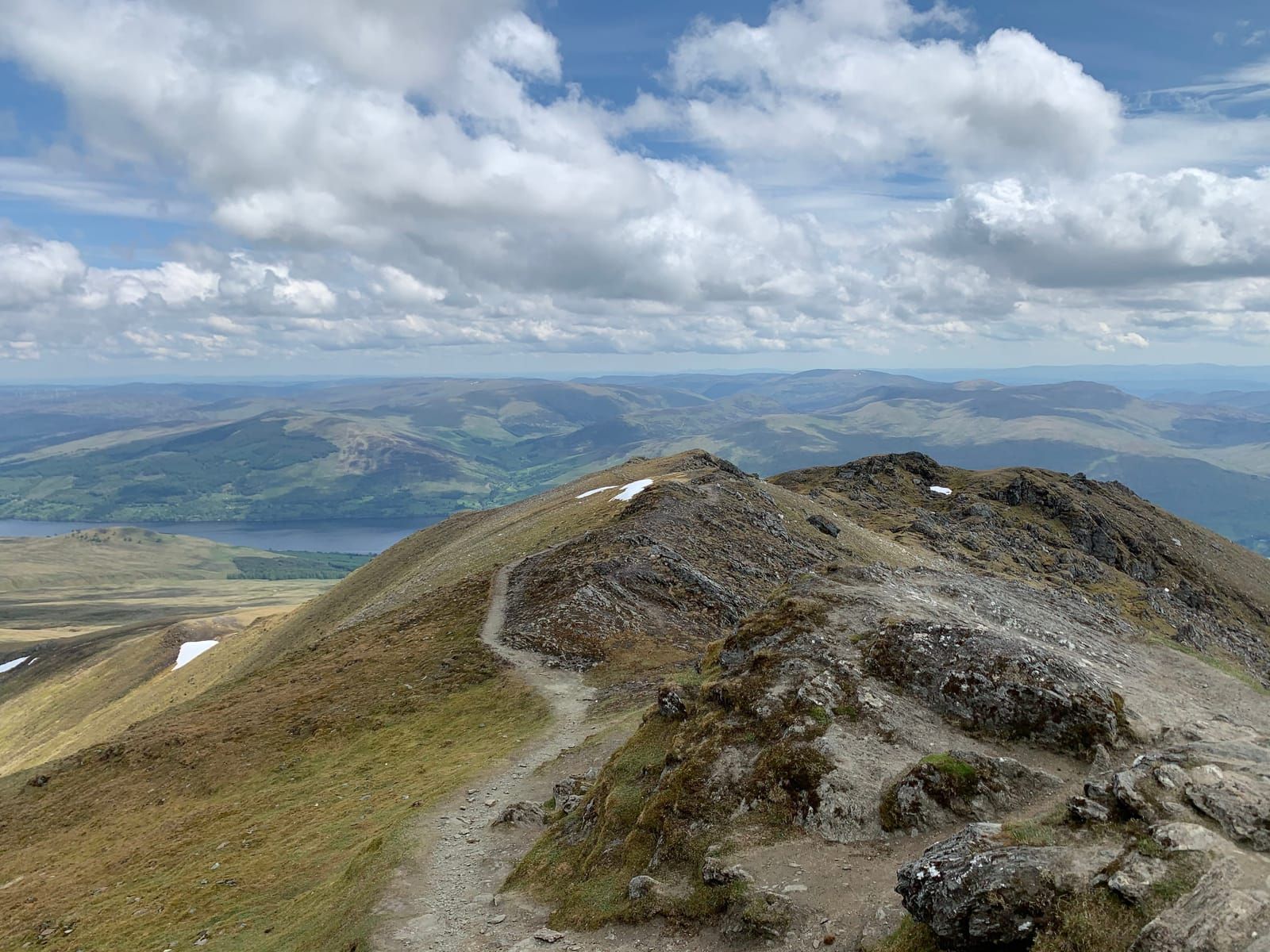
The climbing is gradual and never steep, rising roughly 100 metres above the valley floor. As you gain height, the views along Glen Lyon become increasingly impressive. The glen stretches away in both directions — eastward toward Fortingall and the broad strath of the Tay, westward into the remote mountain heart where the glen narrows and the peaks close in.
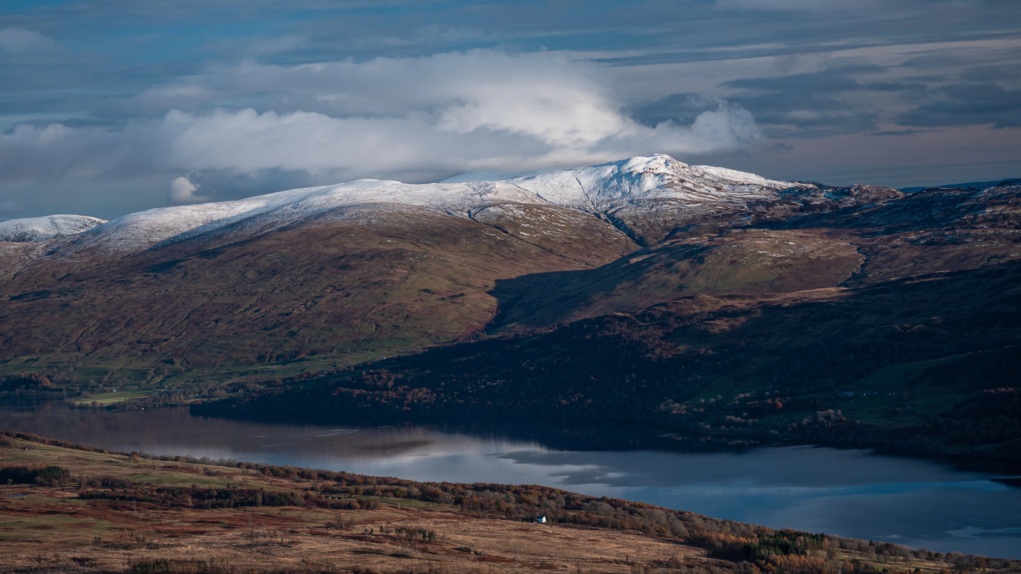
The return leg follows a grassy hill track and then a minor road westward back toward Bridge of Balgie. This elevated route gives a completely different perspective on the glen — you can see the pattern of fields, woodland, and river far below, and appreciate the enormous scale of the landscape. The mountains of the Lawers range fill the southern skyline, and on clear days the Schiehallion — with its distinctive conical profile — is visible to the northeast.
The final section drops back down to the valley floor through sheep pasture and scattered birch trees, rejoining the road a short distance west of Bridge of Balgie. Turn left to return to the car park.
Glen Lyon has been continuously inhabited for thousands of years, and the walk passes evidence of many periods of settlement:
Bridge of Balgie is reached via the minor road from the A827 (Loch Tay north shore). Turn off the A827 at the signed junction approximately 6 miles east of Killin and follow the Ben Lawers hill road over the pass and down into Glen Lyon. Bridge of Balgie is approximately 4 miles from the top of the pass.
Dogs are welcome but should be kept on leads near livestock. The route is suitable for older children comfortable walking 8 km on mixed terrain. The path near Macgregor’s Leap requires some care with younger walkers due to the steep drop into the gorge.
More walks
New guides, seasonal tips, and the odd hidden gem — straight to your inbox. No spam.
We respect your privacy. Unsubscribe anytime.