Falls of Dochart & Inchbuie Walk
A short, easy walk exploring the famous Falls of Dochart and the ancient Clan MacNab burial island in the heart of Killin.
Popular guides
More outdoors
Find by type
Our favourites
Makers & artisans
Shops & local produce
Easy walk
A gentle lochside walk from Killin to the shores of Loch Tay, with beautiful views across the water to the southern hills.
Distance
3 km
Duration
45-60 minutes
Route type
out-and-back
Parking
Falls of Dochart car park, Killin
This short, easy walk connects Killin village with the western shore of Loch Tay — one of Scotland’s great freshwater lochs. It’s perfect for an evening stroll when the light is low and golden, a morning leg-stretch before breakfast, or a family outing with picnic potential on the stony shore. There’s no dramatic climbing, no challenging terrain, and the rewards — loch views, birdlife, mountain reflections — are immediate and generous.
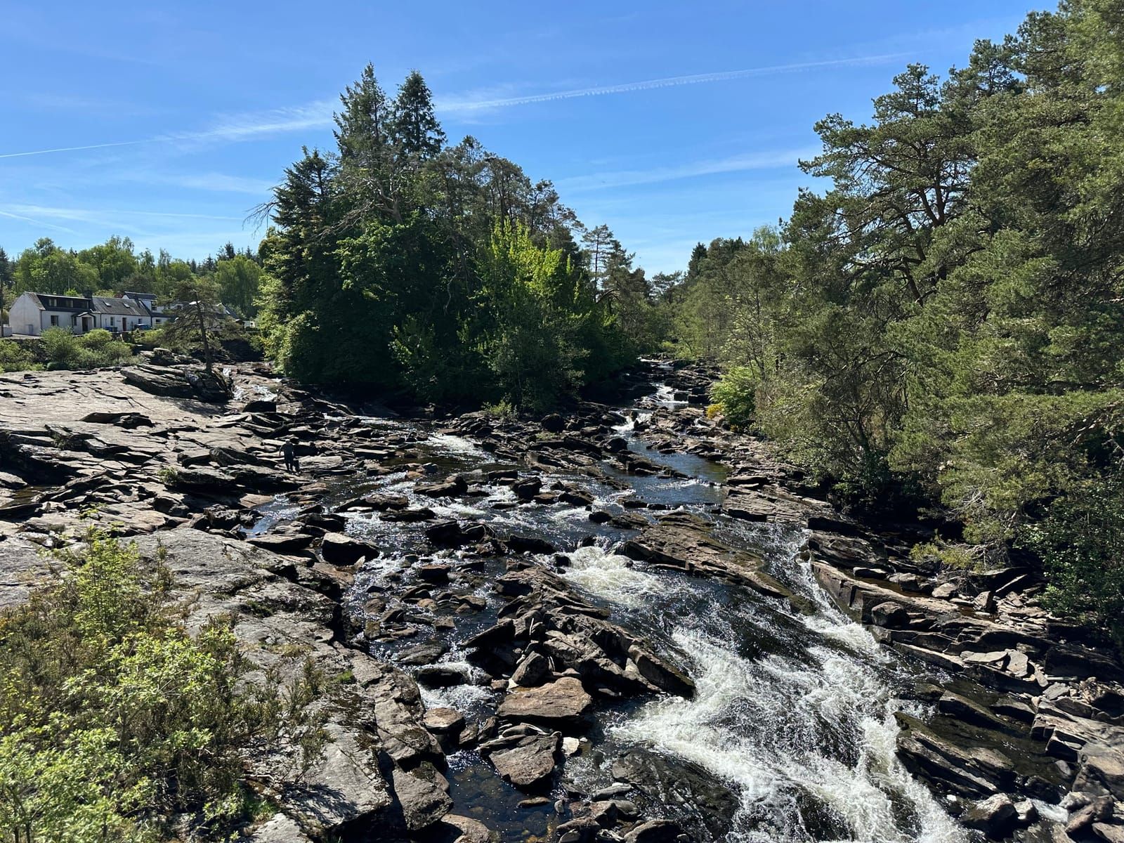
Loch Tay is 14.5 miles long, up to a mile wide, and reaches depths of over 150 metres. It’s a vast, moody body of water that changes character hourly — mirror-calm and silver at dawn, ruffled and steel-grey by midday, ablaze with reflected sunset colours in the evening. This walk takes you to its western tip, where the River Dochart pours in after its dramatic passage through the Falls of Dochart, and the loch begins its long, stately journey eastward towards Kenmore.
Start from the Falls of Dochart car park in the centre of Killin (postcode FK21 8SL). The car park is free and reasonably spacious, though it can fill on summer weekends. If it’s full, there are alternative spaces at the Breadalbane Folklore Centre or along the village streets. The car park puts you right beside the Falls of Dochart, so you can easily combine this walk with the Falls of Dochart & Inchbuie walk for a longer outing.
From the car park, walk east along the main street of Killin. The village itself is worth a moment’s attention — it’s one of the oldest settlements in Perthshire, straddling the River Dochart at the point where the Highlands give way to the broad strath of Loch Tay. The main street has a scattering of traditional stone buildings, several of which house cafes, shops, and the characterful Killin Hotel.
As you leave the village centre, follow the road or the path that runs alongside the River Dochart heading east. The river has already passed through the fury of the falls and is now broader, slower, and calmer — spreading out over a wide, stony bed as it approaches the loch. In low water, the gravel banks are exposed and the river braids into multiple channels. In spate, the whole width runs full and fast.
After roughly 500 metres, you’ll pass an old boathouse on the loch shore — a stone and timber structure that’s been here in one form or another for generations. This is an excellent viewpoint. The loch opens up ahead of you, stretching away to the east, and the full panorama of the southern hills comes into view.
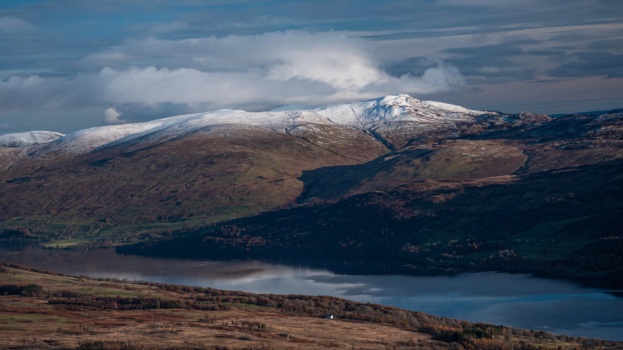
From this spot, the view across the water is dominated by the Tarmachan ridge — a long, undulating skyline of grassy peaks that runs east from Meall nan Tarmachan (1,044m) above the south shore of the loch. The Tarmachans are handsome, sculpted hills — not as high as Ben Lawers, but with an elegant, flowing profile that changes character as the light shifts through the day. In winter, they carry snow on their upper slopes and look properly alpine.
To the south-east, beyond the Tarmachans, you can pick out the hills above Glen Lochay and, on clear days, the distant peaks of the Trossachs. To the north-east, the long flank of the Ben Lawers range rises above the north shore of the loch, its summit often hidden in cloud.
Continue east along the shore for another few hundred metres and you’ll reach the stone beach — a broad, curving expanse of water-rounded pebbles and small cobbles lapped by the loch. This is the natural heart of the walk, and the place to stop, sit, and absorb the view.
The beach is not sand — Loch Tay’s shores are predominantly stone, gravel, and rock, shaped by centuries of wave action and the grinding of ice during the last glacial period. The stones themselves are attractive — a mix of grey schist, white quartzite, and occasionally pink granite, smoothed and rounded by the water. Children love skimming stones here (the flat schist pebbles are ideal), and on calm days the concentric ripples spreading across the still loch surface are hypnotic.
Behind the beach, the ground rises to a grassy bank that’s perfect for picnics. There are no formal benches or facilities, but flat ground, shelter from the wind, and the best view in Killin — what more do you need?
A little further along the shore, partially hidden by alder scrub, you can find the remains of the old pier — stone footings and a few rotting timbers that once served the steamers and cargo boats that plied Loch Tay in the 19th and early 20th centuries. Before the roads were improved, the loch was the main transport route through the strath, and a regular steamer service connected Killin with Kenmore at the eastern end.
The pier is atmospheric in its decay — another small reminder of how much the life of this area has changed in the past century. It’s also another good viewpoint, particularly for watching birds on the loch.
The western end of Loch Tay is one of the better spots in the area for birdwatching, particularly where the river enters the loch. The shallow, nutrient-rich water attracts a variety of species year-round:
Binoculars are a great asset on this walk. Even a small pair will transform your experience of the birdlife.
The view across Loch Tay to the Tarmachan ridge deserves special mention because it’s one of those views that changes constantly and never grows old. In the morning, the hills are often in shadow with the sun behind them, their forms dark and brooding against the sky. By afternoon, the sun illuminates the south-facing slopes and picks out every fold and corrie. In the evening, the low light turns the hills amber and gold, and if the loch is calm, the reflections are spectacular — doubled mountains, doubled sky.
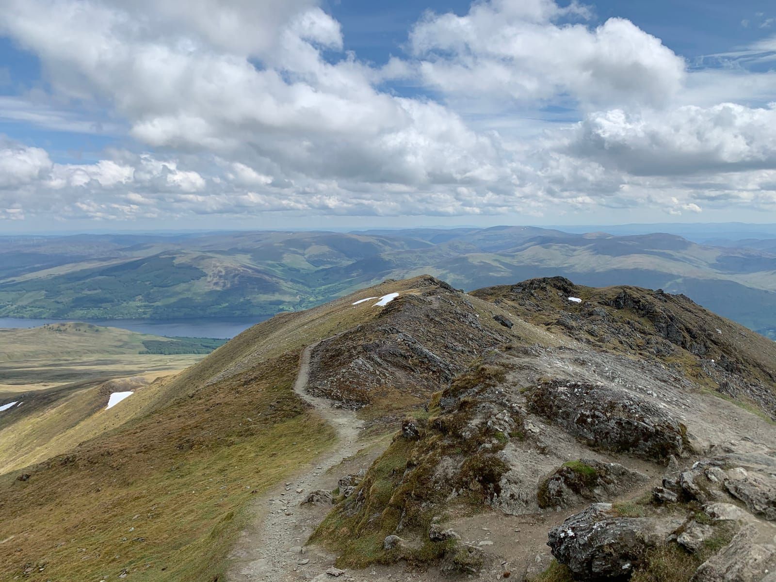
The Tarmachans are Gaelic for “the ptarmigan hills,” and the ridge walk across them (starting from the same road that leads to the Ben Lawers car park) is one of the best day walks in the area — though it’s a serious undertaking at 10 km with significant ascent.
Spring: The river banks come alive with wildflowers — marsh marigold, celandine, and later wild garlic and red campion. Ospreys return in April, and the birdsong along the river is at its best.
Summer: Long evenings make this the perfect after-dinner stroll. The loch is at its warmest (though still cold enough to make swimming bracing), and the stone beach is popular with families. Swallows and martins hawk over the water.
Autumn: Migrant geese arrive, the trees along the river turn gold, and the Tarmachans across the loch get their first dusting of snow. The atmospheric, moody light of October afternoons makes the loch look its most dramatic.
Winter: Short days, but the low-angle light can be extraordinary. Whooper swans and goldeneye on the water. The hills are snow-covered and the loch sometimes steams in the cold air. On rare occasions when the temperature drops sharply, the margins of the loch freeze — a beautiful and eerie sight.
From the lochshore, you have several options:
One of the pleasures of this walk is that it starts and finishes in a village with genuine amenities. Within a few minutes’ walk of the car park:
There are also public toilets in the village centre and the Breadalbane Folklore Centre for rainy-day entertainment.
More walks
New guides, seasonal tips, and the odd hidden gem — straight to your inbox. No spam.
We respect your privacy. Unsubscribe anytime.